
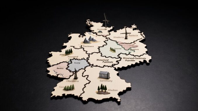
Germany’s 16 federal states distribute power across regions with distinct landscapes, economies, and political priorities. Northern states manage coasts, ports, islands, tourism, and cross-border ties, while city-states Hamburg, Bremen, and Berlin concentrate trade, administration, and metropolitan governance. Larger territorial states coordinate rural services, transport corridors, industry, housing, and environmental protection. Regional identities—from Saxon cities to Brandenburg’s lakes—also shape policy. The state-by-state profiles below clarify these territorial differences.
Schleswig-Holstein: Coasts, Islands, and Nordic Culture
Occupying Germany’s northernmost territory, Schleswig-Holstein is shaped by its position between the North Sea and Baltic Sea and by its land border with Denmark. Its geography divides governance priorities between exposed western marshes, the Baltic’s sheltered bays, and a dispersed island and peninsula landscape. Coastal ecosystems require coordinated flood protection, sediment management, habitat conservation, and adaptation to rising sea levels, particularly within the Wadden Sea zone.
The state’s political identity also reflects cross-border proximity and Danish-German minority rights, which receive institutional protection through schools, cultural bodies, and local representation. Island life on Sylt, Föhr, Amrum, and the Halligen creates distinct pressures involving seasonal population shifts, housing availability, transport links, and tourism regulation. Kiel, the state capital, anchors administrative functions and maritime policy, while smaller coastal communities retain considerable importance in regional planning. Schleswig-Holstein accordingly operates as a borderland state whose environmental management, minority protections, and dispersed settlement patterns shape its public administration.
Hamburg: Germany’s Major Port City-State
Hamburg is a city-state whose political and economic geography is organized around the Port of Hamburg, the Elbe River, and dense metropolitan links extending into Lower Saxony and Schleswig-Holstein. Its compact territory concentrates logistics, finance, media, and Trade and industry within a wider cross-border labor and commuting region. The city’s senate and borough administrations manage urban growth while coordinating transport, housing, flood protection, and port access with neighboring states.
- Port governance: Harbor facilities connect inland European markets to global shipping routes, making dredging, rail capacity, and environmental regulation central political issues.
- Metropolitan integration: S-Bahn corridors, highways, and regional planning bind Hamburg to surrounding municipalities, although jurisdictional boundaries complicate land-use decisions.
- Waterfront identity: Redeveloped docklands, warehouse districts, and working quays illustrate a diverse maritime culture shaped by migration, commerce, and labor.
Hamburg’s federal-state status gives it direct legislative authority, yet its prosperity depends on intergovernmental cooperation across the Elbe metropolitan region.
Mecklenburg-Vorpommern: Baltic Coast and Lake District
Mecklenburg-Vorpommern is defined by its Baltic coastline, including the islands of Rügen and Usedom, which support tourism, ports, and coastal conservation policies. Inland, the Mecklenburg Lake District forms a major freshwater landscape centered on lakes, forests, and protected areas. These contrasting regions shape the state’s infrastructure priorities and rural development strategy.
Baltic Coastline Highlights
Along Germany’s northeastern edge, Mecklenburg-Vorpommern combines a long Baltic shoreline with the Mecklenburg Lake District, making it one of the country’s most distinctive coastal and inland water regions. Its coast stretches from Lübeck Bay toward Poland, organized around ports, islands, lagoons, and protected landscapes. Regional policy balances tourism revenues, maritime infrastructure, and conservation of fragile coastal habitats.
- Rügen and Usedom: Germany’s largest island and the Polish-border island anchor resort economies, with beaches, chalk cliffs, and cross-border transport links.
- Baltic seaside towns: Warnemünde, Kühlungsborn, and Heiligendamm rely on rail access, promenades, and seasonal governance of visitor pressure.
- Hansa trading legacy: Rostock, Stralsund, and Wismar retain port-centered urban identities, strengthened by historic warehouses, UNESCO recognition, and ferry connections across the Baltic.
Mecklenburg Lake District
Inland from the Baltic coast, the Mecklenburg Lake District forms a dispersed water-and-forest landscape centered on the Müritz and hundreds of connected lakes, canals, and wetlands. Its low population density and protected areas, including Müritz National Park, shape a governance agenda focused on conservation, transport access, and seasonal service provision. Municipalities depend on small towns such as Waren and Neustrelitz for administration, health care, retail, and visitor infrastructure. Mecklenburg history remains visible in manor estates, former ducal centers, and settlement patterns shaped by agriculture and postwar land reform. Waterways link the district to Brandenburg and Berlin, supporting boating economies while creating environmental management demands across state and local jurisdictions. Baltic tourism extends inland through cycling routes, holiday homes, and lake-based recreation, broadening the coast’s economic catchment while intensifying pressure on housing, shorelines, and public infrastructure.
Bremen: Small State, Historic Trading Power
Although it is Germany’s smallest federal state by area, Bremen occupies a strategically important position along the Weser River and the North Sea trading corridor. Its territory consists of the cities of Bremen and Bremerhaven, separated by surrounding municipalities, creating an unusual two-city state structure. This geography links inland production zones to Global maritime trade while preserving political autonomy within the federal system.
- Bremen’s port infrastructure channels cargo, vehicles, and logistics services between continental markets and overseas destinations.
- Bremerhaven strengthens the state’s maritime reach through container handling, ship-related industries, and research institutions.
- The legacy of Hanseatic merchant routes remains visible in Bremen’s civic identity, commercial architecture, and external economic orientation.
Governance therefore balances urban planning, port regulation, environmental protection, and fiscal dependence on trade-sensitive sectors. As a city-state, Bremen exercises state-level authority over education, policing, and regional development, while coordinating transport and land-use decisions across jurisdictional boundaries. Its compact scale concentrates economic activity, but also exposes public finances and employment patterns to shifts in shipping volumes and international demand.
Lower Saxony: Coast, Heathland, and Major Cities
Lower Saxony is Germany’s second-largest federal state by area, extending from the North Sea coast and East Frisian Islands through heathland and agricultural plains to the Harz Mountains. Its dispersed geography requires governance across coastal protection, rural services, transport corridors, and metropolitan development. Lower Saxony’s coastline supports ports, fisheries, tourism, and renewable-energy infrastructure, while island communities face distinct environmental and accessibility concerns.
The state’s economy combines manufacturing, agriculture, logistics, and research. Hannover functions as the administrative capital and a central trade-fair location, shaped by Hannover royal heritage and regional rail connections. Other urban centres, including Braunschweig, Oldenburg, Osnabrück, and Göttingen, anchor surrounding districts and university networks. Historic hanse towns such as Lüneburg retain commercial and cultural influence. Lower Saxony’s heaths and moors are important landscapes for conservation, water management, and recreation, but also reflect competing land-use demands. In the Harz, mining heritage, forests, and tourism link environmental policy with local economic planning.
North Rhine-Westphalia: Ruhr Industry and Major Cities
North Rhine-Westphalia is Germany’s most populous federal state, centred on the Rhine-Ruhr metropolitan region and extending from the industrial Ruhr area to the Rhineland, Westphalia, and the low mountain landscapes near its eastern and southern borders. Its governance balances dense urban corridors with rural districts, coordinating transport, housing, energy transition, and municipal finance across highly interdependent territories.
- Ruhr Industrial Heritage: Former coal and steel sites in Essen, Dortmund, Duisburg, and Bochum have been repurposed as cultural, educational, and technology locations, while heavy logistics and manufacturing remain important employers.
- Major Cities Overview: Cologne and Düsseldorf anchor the Rhine corridor through media, trade, administration, and services; Bonn retains federal institutions, while Münster, Bielefeld, and Aachen serve distinct regional functions.
- Regional politics: The state’s size gives it substantial influence in the Bundesrat. Policy debates often connect industrial decarbonisation, structural change, migration, and uneven local fiscal capacity between prosperous Rhine cities and former mining municipalities. Its polycentric structure limits dominance by any single capital.
Hesse: Frankfurt, Finance, and Central Germany
Hesse occupies a central position in Germany, linking major transport corridors and metropolitan regions. Its capital, Wiesbaden, shares statewide influence with Frankfurt, whose financial district hosts the European Central Bank and major banking institutions. This concentration of economic power gives Hesse an outsized role in federal and European regional governance.
Frankfurt’s Financial Powerhouse
At Germany’s geographic center, Hesse combines a strong state capital in Wiesbaden with Frankfurt am Main, the country’s leading financial hub and a major European gateway. Frankfurt concentrates banking, insurance, asset management, and regulatory institutions within a compact metropolitan core, giving Hesse influence beyond its population size. State policy balances Frankfurt’s global role with oversight, housing pressure, and infrastructure demands across the Rhine-Main region.
- The European Central Bank anchors Frankfurt’s continental monetary authority and attracts international firms.
- Financial regulation links federal institutions, Hesse’s government, and municipal planning over offices, transport, and labor markets.
- Islamic banking and other specialized services broaden Frankfurt’s connections with regional financial hubs across Europe and the Gulf.
Wiesbaden provides the administrative counterweight, while Frankfurt supplies fiscal capacity, corporate networks, and international visibility.
Hesse’s Central Location
Situated near Germany’s geographic center, Hesse functions as a key crossroads between the Rhine-Main metropolitan region, central German industrial corridors, and north–south European transport routes. Its position supports dense rail, motorway, and air connections, anchored by Frankfurt Airport and the Rhine Main hub. This Central crossroads role links western manufacturing regions with eastern markets and channels international investment toward the federal interior.
State policy thus emphasizes transport capacity, housing, and coordinated metropolitan planning across Frankfurt, Wiesbaden, Darmstadt, and surrounding districts. Hesse’s government must balance the economic weight of the south with smaller cities and rural areas in the north and east. Fiscal revenues generated by finance, logistics, and advanced services strengthen statewide infrastructure, while congestion, land pressure, and uneven regional development remain central political concerns for territorial governance and long-term cohesion.
Rhineland-Palatinate: Wine Regions and Roman Heritage
Rhineland-Palatinate occupies a strategically varied southwestern territory shaped by the Rhine, Moselle, and Nahe river corridors, whose valleys support some of Germany’s most important wine-producing areas. Its landscape combines steep vineyard slopes, forested uplands, and transport routes linking metropolitan markets with rural districts. The state government balances agricultural protection, tourism development, and infrastructure planning across dispersed communities.
- The Rhineland wine regions, including the Moselle, Mittelrhein, Nahe, and Pfalz, underpin local employment, export identity, and land-use policy.
- Trier’s Roman heritage sites, including the Porta Nigra, imperial baths, and amphitheatre, position the state within European cultural tourism networks.
- Mainz, the capital on the Rhine, concentrates administrative authority while serving as a media, research, and logistics centre.
Regional politics frequently addresses flood protection, vineyard adaptation to climate change, and equitable investment between river valleys and interior areas. Municipal cooperation is essential because tourism, heritage management, and environmental regulation cross district boundaries.
Saarland: French Influence on Germany’s Western Border
Saarland’s position along the French border has produced a distinct Franco-German cultural landscape shaped by cross-border mobility and shared institutions. Its coal, steel, and manufacturing legacy continues to influence settlement patterns, employment, and regional policy. Local cuisine and traditions reflect this borderland exchange, combining German and French culinary practices in everyday life.
French-German Cultural Blend
Along Germany’s western border, Saarland functions as a contact zone where French influence has been shaped by proximity, cross-border labor markets, and repeated shifts in sovereignty. Its cultural geography reflects Versailles influence and later postwar arrangements, which connected local administration, education, and public life to neighboring France. Rather than forming a simple border, the region operates through overlapping networks extending toward Lorraine and Luxembourg.
- Language: Bilingual traditions appear in school partnerships, municipal exchanges, signage, and everyday familiarity with French.
- Governance: The Saar-Lor-Lux framework encourages coordinated planning on mobility, tourism, environmental management, and workforce access.
- Identity: Regional political culture balances German federal membership with a distinct western orientation, reinforced by cross-border institutions.
This blend is most visible in border municipalities, where commuting patterns and civic cooperation make national boundaries administratively significant yet socially permeable.
Saarland’s Industrial Heritage
Coal mining and steel production shaped Saarland’s settlement patterns, transport corridors, and political economy from the nineteenth century onward. Pits, coking plants, rail lines, and river-linked industrial sites concentrated population in a dense corridor around Saarbrücken, Völklingen, and Neunkirchen. The Saar coal legacy created municipalities dependent on large employers, unionized labor, and infrastructure designed for extraction and heavy manufacturing. Steelmaking towns retained strategic importance through changing customs regimes and cross-border supply chains.
Territorial governance reflected this industrial geography. Periods of international administration and economic alignment with France influenced ownership structures, market access, and regional planning. The French border legacy remains visible in transport coordination and labor mobility. Since mine closures and industrial restructuring, Saarland has pursued conversion of former worksites, workforce retraining, and diversified investment while preserving industrial heritage as a regional asset.
Borderland Cuisine And Traditions
Border proximity to France has made cuisine and everyday custom a durable marker of Saarland’s regional identity. Cross-border labor, trade, and shifting sovereignty encouraged a culinary zone where French techniques met German staples. Regional governance now promotes this heritage through markets, tourism, and municipal partnerships across the frontier.
- Dibbelabbes, a potato dish, reflects working-class food traditions shaped by industrial settlements.
- Lyoner sausage, despite its name, illustrates how French culinary vocabulary entered local production and commerce.
- Family meals often feature wine, cream sauces, and seasonal produce linked to nearby Lorraine.
Unlike Kiel canal history, which foregrounds northern strategic infrastructure, Saarland’s border politics centers on everyday mobility. Danish border influences offer another comparison: both regions convert linguistic and culinary exchange into symbols of territorial distinctiveness within the federal republic.
Baden-Württemberg: Black Forest, Cars, and Innovation
Baden-Württemberg occupies Germany’s southwest, where the Black Forest, the Upper Rhine plain, and the Swabian Jura shape a territorially diverse and economically powerful state. Its borders with France and Switzerland support cross-border labor markets, transport corridors, and metropolitan cooperation around Karlsruhe, Freiburg, and the Rhine valley.
State governance balances strong municipalities with regional planning bodies that manage housing, mobility, energy, and landscape protection. Stuttgart, the capital, anchors an industrial corridor extending through Heilbronn, Ulm, and the Neckar basin. Automobile manufacturing, engineering, software, and research institutions underpin Stuttgart innovation, while smaller towns contribute specialized machinery and export industries.
Tourism remains important in upland districts, where Black Forest legends, spa towns, hiking routes, and timber landscapes reinforce a distinct regional identity. Political debate often centers on rail expansion, renewable energy, agricultural land, and the transformation of automotive employment. This combination of decentralized production, scientific capacity, and protected landscapes gives the state influence beyond its territorial size.
Bavaria: Alps, Beer Halls, and Regional Pride
Bavaria’s southern Alpine frontier, marked by lakes, castles, and mountain corridors, gives the state a distinct territorial profile within Germany. Beer halls and major festivals function as civic institutions that connect local economies, tourism, and public culture. Bavarian identity is reinforced through regional traditions, dialects, and strong political support for state autonomy.
Alpine Landscapes And Castles
In southeastern Germany, Bavaria’s Alpine fringe concentrates some of the state’s most recognizable landscapes and symbols of regional identity. Mountain corridors along Austria shape transport planning, tourism regulation, water management, and cross-border cooperation. Alpine landscapes also reinforce Bavaria’s political distinction within the federal republic, linking rural districts to a powerful state-level narrative of heritage and autonomy.
- The Allgäu and Upper Bavarian Alps combine protected habitats, ski infrastructure, and municipal development pressures.
- Neuschwanstein and Hohenschwangau demonstrate how castles history is administered through state heritage agencies, visitor controls, and regional transport networks.
- Borderland geography gives districts near Garmisch-Partenkirchen and Berchtesgaden strategic roles in environmental governance and Alpine mobility.
These territories balance preservation with economic dependence on visitors. Their visual prominence supports Bavaria’s external image while requiring coordinated land-use policy across sensitive mountain communities and protected areas.
Beer Halls And Festivals
Across Bavaria, beer halls and festivals operate as civic spaces where local identity, municipal regulation, tourism economies, and state-wide tradition converge. Municipalities license venues, manage public safety, and coordinate transport networks as seasonal events concentrate residents and visitors in historic centers, fairgrounds, and market squares. Munich’s Oktoberfest traditions illustrate the scale of this governance: temporary infrastructure, policing, sanitation, and transit planning transform the Theresienwiese into a regulated urban district. Elsewhere, smaller festivals support local hospitality sectors and reinforce links between towns and surrounding agricultural areas. Brewery history also shapes regional economic geography, with established producers anchoring employment, distribution routes, and property holdings across Franconia, Upper Bavaria, and Swabia. Beer halls consequently function beyond consumption venues, serving as meeting places within municipal life and visible nodes in Bavaria’s tourism strategy.
Bavarian Identity And Traditions
Beyond its administrative boundaries, Bavarian identity is sustained through a strong regional political culture that links landscape, language, religion, and public tradition. Alpine districts, Catholic pilgrimage routes, and Munich’s metropolitan institutions create distinct territorial reference points within Germany’s federal system.
- The Alps anchor tourism, environmental policy, and borderland cooperation with Austria.
- Beer halls function as civic spaces where local associations, municipal leaders, and voters reinforce social networks; Oktoberfest etiquette reflects regulated public participation.
- Bavarian folk music, dialects, and costume societies preserve regional markers across rural communities and expanding cities.
The Christian Social Union has long translated this identity into state-level governance, defending fiscal autonomy and cultural authority. Regional pride operates not merely as symbolism, but as a political resource shaping Bavaria’s position within the federation.
Thuringia: Forests, Castles, and Cultural Landmarks
Thuringia occupies a central position in Germany, where the Thuringian Forest and basin landscapes have historically shaped settlement, transport, and economic development. Erfurt, the state capital, functions as an administrative and logistical hub, linking smaller industrial towns, rural districts, and national rail corridors. The Land government balances infrastructure investment with conservation across heavily wooded uplands and agricultural lowlands.
Cultural assets carry substantial regional-policy significance. Eisenach’s Wartburg legend connects the state to medieval authority, religious reform, and tourism management, while Weimar heritage anchors internationally recognized institutions associated with literature, art, and constitutional history. These sites support visitor economies but also require coordinated preservation funding among municipal, state, and federal bodies.
Thuringia’s territorial structure remains shaped by dispersed urban centers rather than one dominant metropolis. Regional planning thus emphasizes access to public services, workforce retention, and connections between peripheral communities and central German markets. Its forests, castles, and cultural institutions form both protected landscapes and strategic development resources.
Saxony: Dresden, Leipzig, and Saxon Culture
Saxony occupies Germany’s eastern borderland, where the Elbe corridor, Ore Mountains, and Lusatian landscapes shape settlement, industry, and cross-border connections with Poland and the Czech Republic. Its territorial pattern combines metropolitan growth, former mining districts, and rural areas facing demographic pressure. Dresden anchors state administration along the Elbe river, while Dresden art institutions project the capital’s baroque and modern cultural identity.
- Leipzig functions as Saxony’s western economic pole, supported by logistics, manufacturing, universities, and a growing creative sector.
- Dresden concentrates government, research facilities, semiconductor production, and cultural assets, linking public administration with export-oriented technology.
- Lusatia and the Ore Mountains illustrate regional shift: coal phaseout, renewable-energy planning, tourism, and cross-border cooperation require coordinated investment.
Saxon politics often balances urban dynamism against peripheral concerns over infrastructure, services, and representation. The Landtag in Dresden directs education, policing, cultural funding, and regional development, while municipalities manage local implementation. Historical identities remain influential in debates over migration, industrial policy, and relations between eastern and western Germany.
Saxony-Anhalt: Bauhaus Landmarks and Medieval Cities
Situated between the Harz Mountains, the Elbe valley, and the agricultural plains of central Germany, Saxony-Anhalt combines dispersed industrial centers with historically significant urban landscapes. Its territorial structure reflects postwar administrative consolidation: Magdeburg serves as the state capital and river-port center, while Halle anchors the southern metropolitan corridor with university, chemical, and logistics functions. Dessau-Roßlau gives the state international cultural visibility through its Bauhaus legacy, including the Bauhaus Building and Masters’ Houses, which shape heritage policy and tourism investment.
Smaller cities reinforce a networked regional identity. Quedlinburg preserves extensive medieval streets and timber-framed districts, supported by UNESCO designation and conservation-led local development. Wittenberg links urban heritage to Reformation history, while Naumburg’s cathedral strengthens the southern cultural corridor. State planning must balance demographic decline, municipal fiscal pressures, and infrastructure needs across rural districts. Consequently, cultural assets function not merely as attractions, but as instruments for regional branding, redevelopment, and intermunicipal cooperation.
Brandenburg: Lakes, Forests, and Berlin’s Hinterland
Encircling Berlin, Brandenburg forms a largely rural state shaped by extensive forests, lake districts, agricultural land, and the metropolitan pull of the capital. Its territorial priorities balance settlement growth, environmental protection, transport access, and fiscal disparities between prosperous commuter belts and peripheral districts.
- Water landscapes: The Spreewald, Havelland, and Uckermark structure tourism and conservation policy. Brandenburg lakes cruises support local economies while requiring coordinated shoreline, habitat, and navigation management.
- Metropolitan governance: Housing pressure and industrial investment concentrate along rail corridors and Berlin’s hinterland routes. State planning seeks to direct growth toward regional centres, limiting scattered development and protecting open land.
- Political geography: Potsdam anchors administration, research, and services, while eastern and northern areas face ageing populations and weaker infrastructure. Debates over renewable-energy sites, grid expansion, and agricultural land use reveal competing municipal interests.
Brandenburg’s governance thus depends on managing interdependence: supplying metropolitan functions while retaining distinctive landscapes, local autonomy, and viable smaller towns.
Berlin: Germany’s Capital City-State
At the centre of Brandenburg’s metropolitan region, Berlin operates as both Germany’s capital and a federal city-state, combining municipal and Land-level authority within a dense urban territory. Its Senate functions as the state government, while twelve boroughs administer local services, planning, and neighbourhood representation. Capital governance must coordinate national institutions, diplomatic districts, transport systems, housing pressures, and metropolitan links extending into surrounding Brandenburg.
Berlin history remains visible in its urban form. The former divided city produced contrasting development patterns between eastern and western districts, while the route of the Wall still shapes public space, property markets, and memorial landscapes. Reunification restored Berlin’s federal capital role and accelerated redevelopment around the Reichstag, government quarter, Potsdamer Platz, and Hauptbahnhof.
Modern landmarks, cultural institutions, universities, and technology clusters reinforce Berlin’s international profile. Yet rapid population growth and uneven investment intensify debates over rents, infrastructure capacity, social cohesion, and the city-state’s fiscal relationship with Germany’s wider federal system.

The Germany Explained Editorial Team provides accessible background information on Germany for an international audience. The team explains institutions, economic concepts and terminology that are often difficult to understand from outside the country, from the Bundestag, Bundesrat and federal states to the Mittelstand, Ausbildung, Energiewende and Industry 4.0. The objective is simple: to make Germany easier to understand.